Winds aloft pattern suggests a significant autumnal cool down at the end of next week as we welcome the month of October.
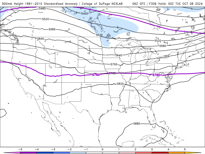
Winds aloft pattern suggests a significant autumnal cool down at the end of next week as we welcome the month of October.
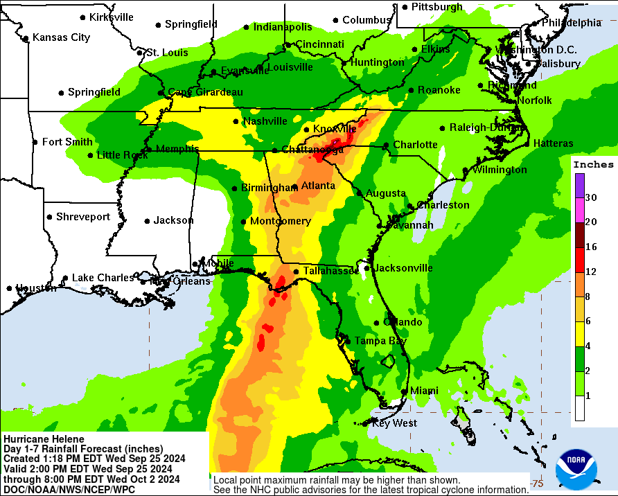
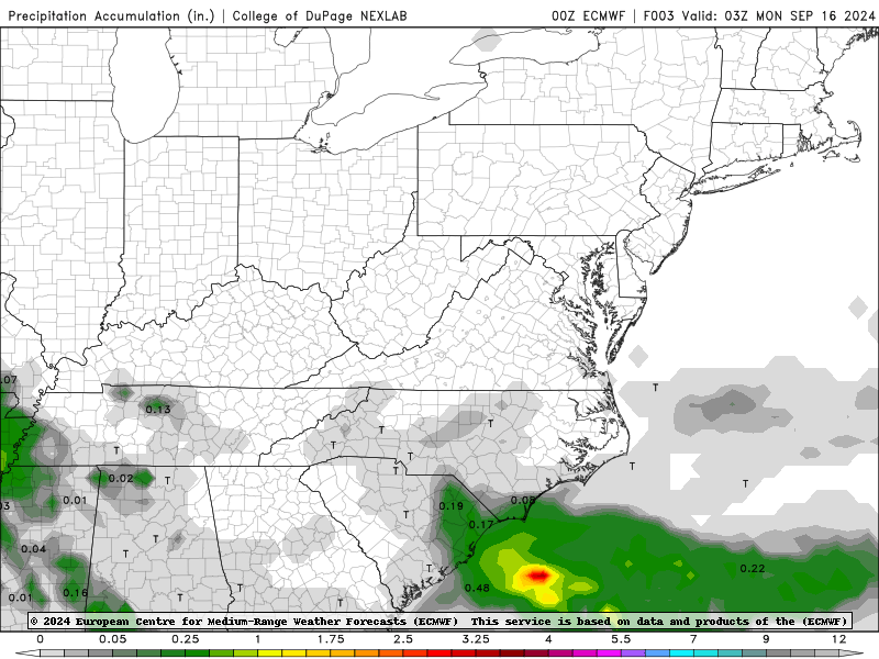
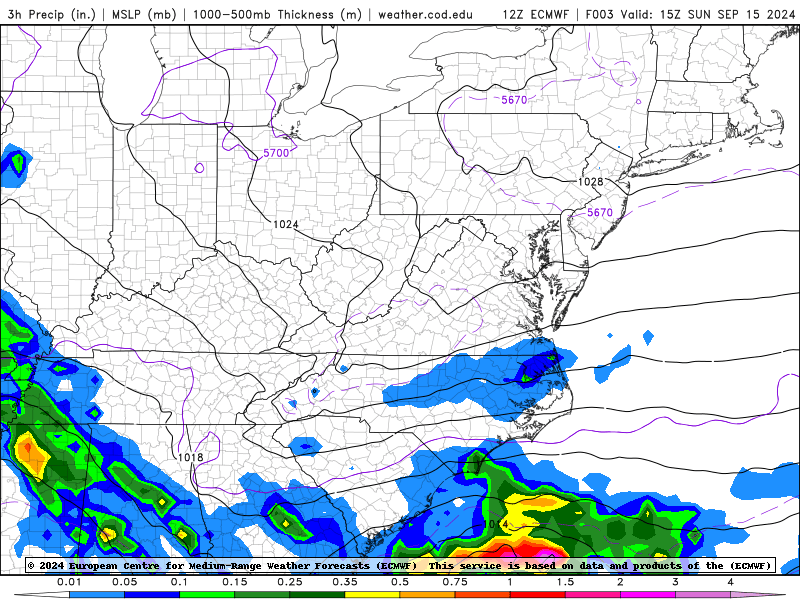
High pressure may block most, if not all, of the rainfall from pushing north off the Ohio River.
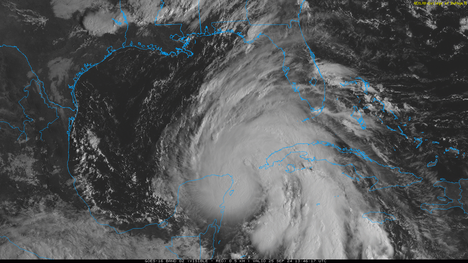
Current visible satellite loop as of 1:30 PM Wednesday:
Sunday, September 22, 2024
Measurable rain moved in before midnight Sunday, so that means the most recent dry streak at 14-days ties the longest September rain-free period established in 2017 and 2020… and now 2024.
Monday, September 16
We are watching with great interest the pseudo-tropical system trying to push enough moisture NW to generate a few showers in Ohio on Wednesday … but the strong high pressure system overhead will do everything it can too allow our current dry streak to continue.
Call it an exciting atmospheric football game unfolding before our eyes.
I’ll have an updated forecast on WKJA-FM, 91.9 FM (or on HeartfeltRadio.org).
Monday, September 16
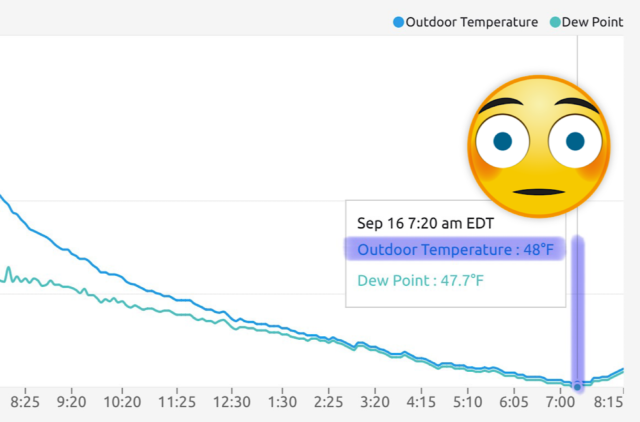
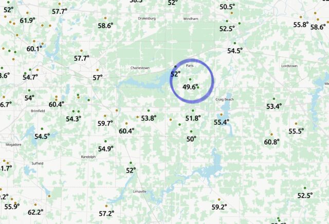
With longer nights, the atmosphere has a longer time to cool off at night. Case in point, this Ambient backyard weather station near Ravenna had an overnight low of 48°F this Monday morning!
Sunday, September 15, 2024
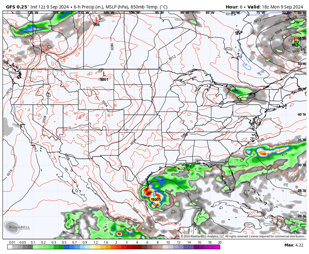
A tropical system may try to put an end to a dry streak that will reach 9 days on Monday. This all depends on how much of a fight a tropical type system off the east coast puts up against a long-term high pressure system over the Ohio Valley. Stay tuned to my latest forecasts on WKJA-FM, 91.9 or online at HeartfeltRadio.org
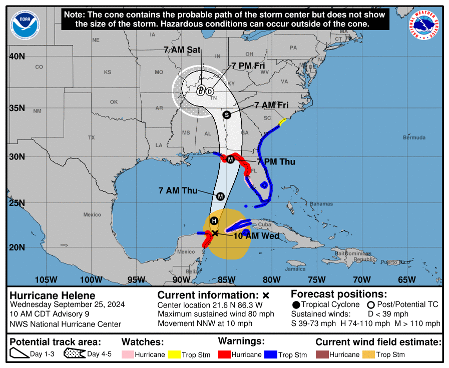
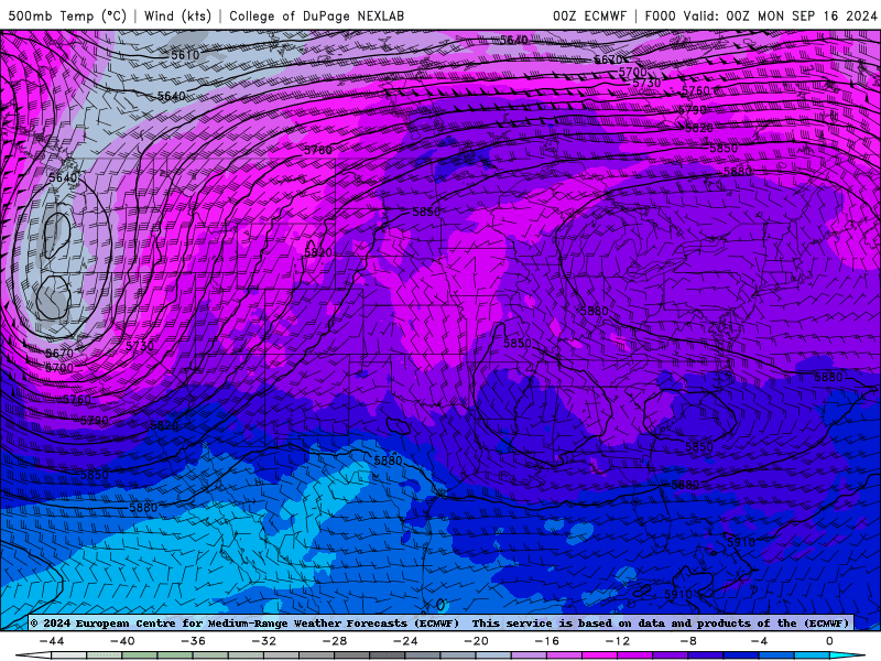
Despite an upcoming hurricane (Francine) trying to push moisture into the Ohio Valley, notice how the blocking surface high keeps the rain at bay through the weekend. Let’s see if this futurecast “holds water.” Stay tuned!
Wednesday, September 4, 2024
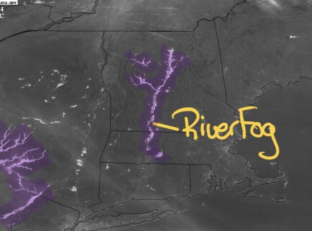
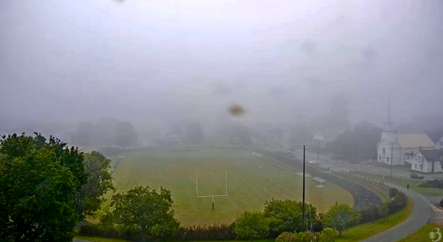
This morning’s visible satellite image was a classic example of the (Connecticut) river fog that develops on clear, calm, and cold mornings.
This is what it looked like from the north end of that foggy string. This web camera is at Lyndon Institute in Lyndonville, Vermont.
Tuesday, September 3, 2024
How about that? A September morning that is actually paying attention to the calendar!
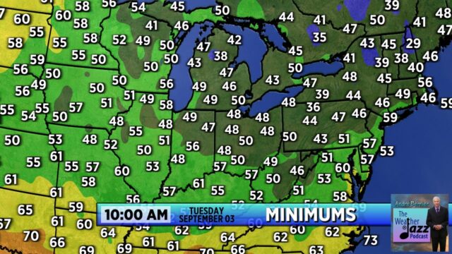
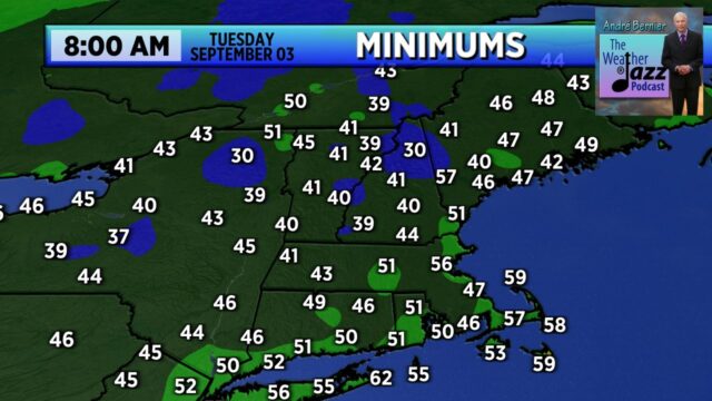
The overall pattern will feel quite autumnal in the next 10 days.