Skip to content
Home
Weather
Page 11
Category:
Weather
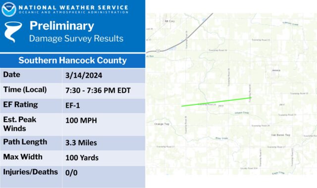
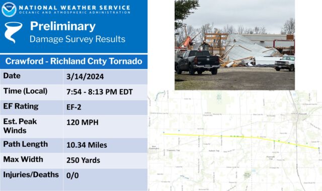
Confirmed Tornadoes
Posted on
March 15, 2024
March 18, 2024
By
Andre
News
,
Weather
Posts pagination
Previous
1
…
10
11