Category: Weather
Look at the extent of the wintry conditions from ONE winter storm!
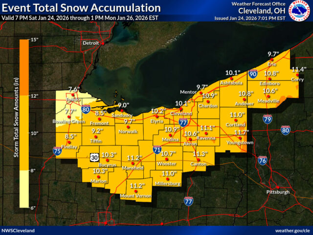
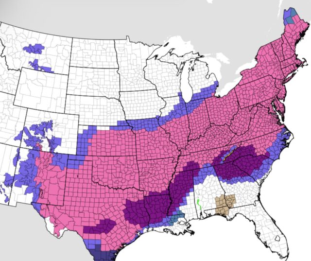
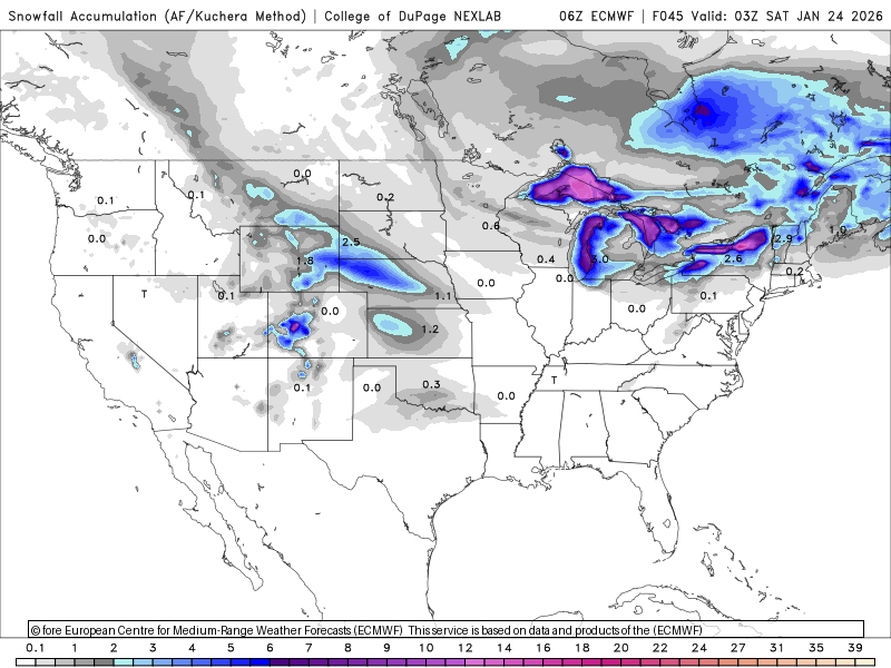
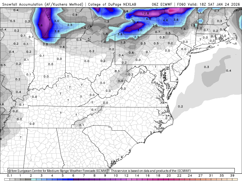
`The winter of 2025-2026 will be remembered for this upcoming weekend system, the likes of which we’ve not seen for many years. The swath of debilitating snow will span over two thousand miles between Saturday night and Monday morning.
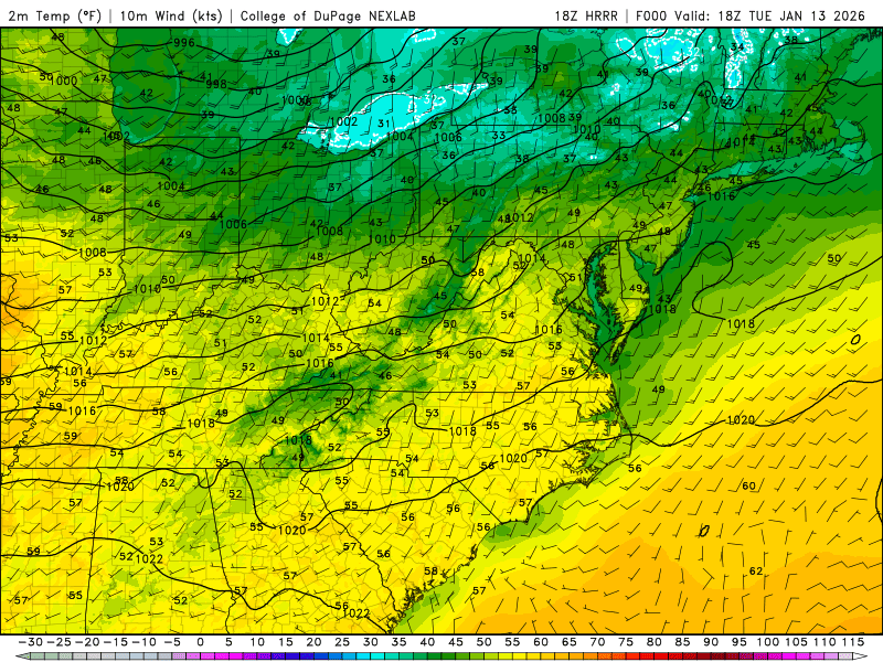
A powerful cold front will arrive on Wednesday. The mildest part of the day will be when we wake up. Watch the dramatic fall in temperture between Wednesday morning and Wednesday afternoon!
After a week of thawing temperatures, the wintry chilling on the way back into the Great Lakes.
Spotted on this morning’s visible satellite image:

Here’s what they may look line from your backyard if you lived in Virginia:

Gravity wave clouds are beautiful, rippling cloud formations, like waves on water, that form in stable air when wind flows over obstacles (mountains, fronts) or disturbances, forcing air up and down in oscillations; moisture condenses at wave crests (clouds) and evaporates in troughs (clear skies), creating distinct patterns visible from space and on radar, often indicating turbulence for aircraft.
How They Form
- Trigger: Stable air encounters a barrier (mountains, thunderstorms, cold fronts) or wind shear, forcing it upward.
- Oscillation: Gravity pulls the air back down, but it overshoots and starts bouncing up and down (oscillating) like a wave in water.
- Cloud Formation:
- Crests (Upturns): Air rises, cools, and moisture condenses, forming clouds.
- Troughs (Downturns): Air sinks, warms, and clouds evaporate, creating clear patches.
- Appearance: This creates long, parallel lines or ripple patterns of clouds and clear sky, spreading out from the disturbance.


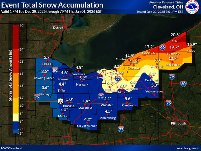
Two more “clippers” will bring a general inch or two of snow with lake effect squalls behind each one between now and New Year’s Day. This might be a good year to celebrate the new year off the roads.
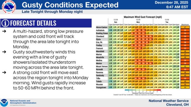
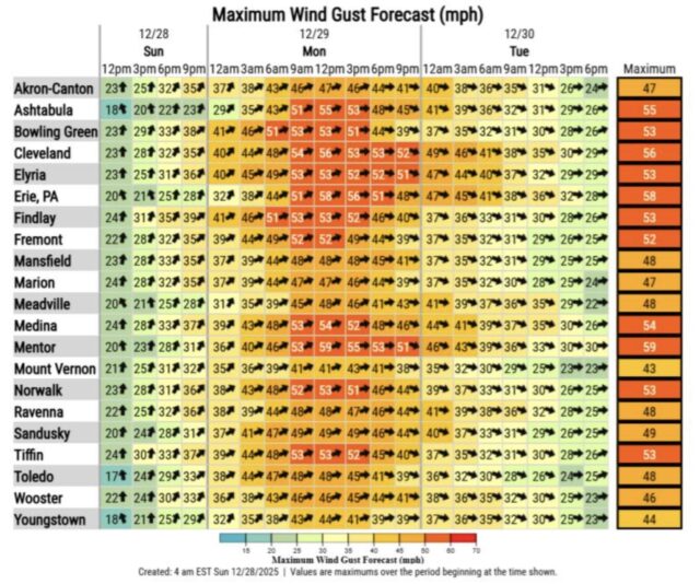
Along with rapidly falling temperatures on Monday:
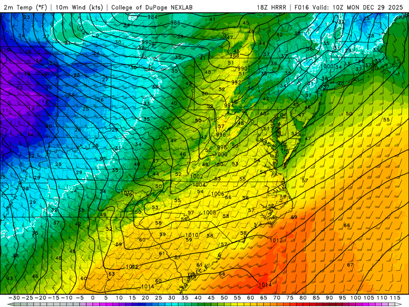
Explosively developing storms LOVE feeding off HUGE thermal contrasts in very short distances like the one we are seeing this Sunday morning in the Midwest.
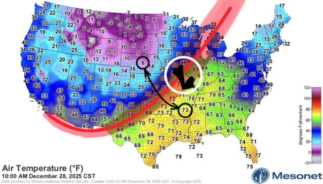
This is the reason behind the high wind warning for our area, especially on Monday.